Home
» New Trends
»
The Anatomy of Commercial Drones: Hardware Breakthroughs Behind Autonomous Flight
The Anatomy of Commercial Drones: Hardware Breakthroughs Behind Autonomous Flight
A modern commercial drone is best understood as a compact flying robot, not simply an airframe with a camera. Its real value comes from how well propulsion, power, navigation, perception, onboard computing, communications, payloads, and safety logic work together under the conditions of a real mission.
That distinction matters because an impressive specification can still produce weak results. A long flight-time claim does not guarantee useful endurance with a heavy payload. Obstacle avoidance does not guarantee safe autonomous navigation in darkness, fog, reflective environments, or featureless terrain. A high-resolution camera does not guarantee survey-grade data unless position accuracy, calibration, motion control, and processing are also appropriate.
By the end of this article, you should be able to look at a commercial drone architecture and ask a better question than “How advanced is it?” The more useful question is: “Can this system repeatedly produce the mission outcome I need, with measurable margins and acceptable operational risk?”
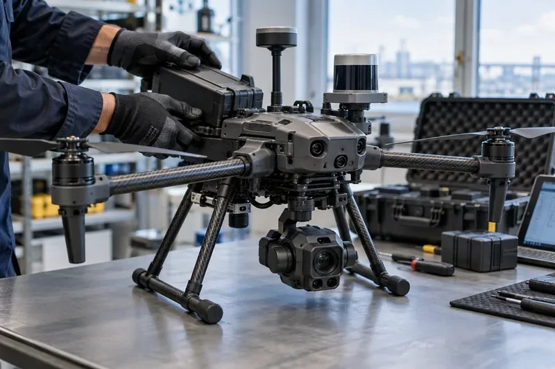
A commercial multirotor on an inspection bench shows how battery, propulsion, navigation sensors, onboard perception hardware, communications, and payload systems must work as one integrated aircraft.
What is inside a commercial drone?
Although designs vary from small quadcopters to fixed-wing survey aircraft and heavy-lift platforms, most commercial drones contain the same functional layers. Open autopilot documentation from PX4 describes a familiar control chain: sensors feed state estimation, guidance and navigation create setpoints, controllers calculate corrections, and actuators turn those corrections into motor or servo movement.
Supplies energy to motors, computers, sensors, and payloads
Useful mission endurance with reserve, stable voltage under load, and repeatable battery health
Navigation sensors
Estimate attitude, position, altitude, heading, and velocity
Stable state estimates with graceful fallback when one source degrades
Perception sensors
Detect obstacles, terrain, targets, or inspection features
Reliable detection in the intended lighting, texture, range, and weather envelope
Flight controller
Runs stabilization and flight-control loops
Fast, deterministic control with tested failure handling
Edge computer
Runs computer vision, mapping, planning, and AI workloads
Low-latency inference without consuming an excessive power or thermal budget
Communications
Moves command, telemetry, video, and mission data
Known coverage, link-quality monitoring, and safe lost-link behavior
Payload
Performs the business task: imaging, thermal inspection, LiDAR, delivery, sensing, or other work
Data quality that meets the acceptance criteria for the mission
1. Airframe and propulsion: the first performance envelope
Multirotors dominate many inspection, public-safety, photography, and close-range mapping jobs because they can hover and maneuver precisely. Fixed-wing aircraft are usually more efficient for long-distance coverage, while hybrid VTOL designs try to combine vertical takeoff with efficient forward flight.
Brushless motors, modern electronic speed controllers, lighter composite structures, larger efficient propellers, and better control firmware have steadily expanded what electric commercial drones can carry. But the important metric is not maximum payload or maximum flight time separately. It is endurance at the payload, temperature, wind, altitude, and reserve policy you will actually use.
A useful current example is DJI's Matrice 400 specification sheet. The manufacturer lists a maximum payload of 6 kg and up to 59 minutes of no-wind flight time under a defined test configuration. Those figures illustrate the progress of heavy enterprise multirotors, but DJI also states that real performance varies with environment, payload, and firmware. That caveat is exactly how such numbers should be read.
Quality check
Measure mission endurance with the operational payload installed and with a conservative landing reserve. If field endurance is consistently far below what the mission needs, increasing battery capacity may not be the best answer because larger batteries add weight. A different airframe class, a lighter payload, shorter routes, or a dock-based operating pattern may produce a better overall result.
2. Power systems: autonomy still runs on an energy budget
Every autonomous feature competes for the same stored energy. Motors consume most of it, but high-performance compute modules, heated batteries, cellular radios, radar, LiDAR, lights, and multiple cameras can materially change the power budget.
This is why battery quality is more than capacity in watt-hours. Commercial operators should care about cell consistency, temperature behavior, cycle aging, state-of-charge estimation, charging time, battery logs, and whether the aircraft can detect abnormal voltage or temperature early enough to react safely.
A healthy power architecture is visible in the data: battery voltage does not sag unexpectedly under normal acceleration, remaining capacity estimates are repeatable, and the mission planner uses a reserve that reflects wind and route geometry rather than a fixed optimistic percentage.
3. Navigation: sensor fusion is the hidden core of autonomous flight
Autonomy begins with knowing the aircraft's state. The PX4 sensor documentation lists the core building blocks: gyroscope, accelerometer, magnetometer, and barometer, with GNSS or another positioning source needed for many automatic modes. Commercial systems may add dual GNSS, RTK corrections, visual odometry, LiDAR odometry, radar altitude, or terrain-relative navigation.
RTK can improve positioning dramatically when correction data and satellite geometry are available. DJI, for example, specifies centimeter-class RTK accuracy for the Matrice 400 under its stated conditions. But high-precision GNSS is not the same as resilient navigation. Urban canyons, steel structures, electromagnetic interference, multipath reflections, tree cover, and indoor environments can all weaken satellite-based positioning.
The breakthrough is therefore not one “perfect” sensor. It is better fusion: combining inertial, satellite, visual, ranging, and sometimes radar data so the vehicle can detect disagreement and continue with an appropriate fallback.
Quality check
Do not evaluate navigation only in an open field. Test the hardest environments the operation actually includes. Look for position jumps, heading instability, frequent mode changes, or operator interventions. If the system becomes unreliable whenever GNSS quality drops, a visually or LiDAR-aided navigation approach may be more appropriate.
4. Perception hardware: cameras are now only one layer
Commercial drones increasingly combine several sensing modalities. RGB cameras provide rich visual detail. Thermal cameras support heat-loss inspection, firefighting, industrial maintenance, and search operations. LiDAR measures geometry directly. Infrared range sensors help with short-range depth. Radar can add useful obstacle information where visible-light cameras are less reliable.
The sensor stack on DJI's current Matrice 400 shows how far this has progressed: the official specification lists omnidirectional binocular vision, rotating and upward LiDAR, a downward 3D infrared range sensor, and six-direction mmWave radar. The same page also documents environmental limitations for vision sensing and notes that some radar functions may be restricted by region. That is an important reminder that “omnidirectional sensing” is not the same as “unconditional obstacle avoidance.”
For another architecture, Skydio says its X10 uses six navigation lenses for 360-degree visibility and an onboard NVIDIA Jetson Orin GPU. Its operator materials describe 360-degree obstacle avoidance, real-time 3D mapping, visual navigation, motion planning, waypoint missions, and visual return-to-home. These capabilities show the direction of the market: perception and planning are increasingly onboard rather than being dependent on a remote computer.
Quality check
Judge perception by missed obstacles, false detections, minimum reliable feature size, usable range, low-light behavior, and performance around glass, wires, repetitive textures, dust, rain, and moving objects. If one environment repeatedly causes uncertainty, change the sensor mix or the operating procedure rather than assuming more AI alone will solve it.
5. Edge AI: more compute changes what can happen onboard
Onboard AI accelerators allow drones to run object detection, visual navigation, mapping, tracking, semantic understanding, and route planning with lower latency than a cloud-only design. NVIDIA's current Jetson line demonstrates the scale of embedded computing now available: its official comparison lists 67 TOPS for the Jetson Orin Nano Super developer kit and 275 TOPS for the Jetson AGX Orin developer kit, with different power envelopes.
Raw TOPS, however, is not a mission metric. A drone computer must fit within mass, thermal, power, memory, and reliability constraints. A smaller model running predictably at the edge can be more useful than a much larger model that overheats, drains the battery, or adds latency to flight-critical perception.
The strongest architecture also separates responsibilities. Stabilization and essential flight safety should not depend on a large AI model. AI perception can suggest obstacles, targets, or routes, while lower-level flight control remains deterministic and independently monitored.
6. Communications: a data link is not a substitute for autonomy
Commercial missions may use dedicated radio links, Wi-Fi-class links, cellular connectivity, satellite services, or combinations of them. The link carries control commands, telemetry, video, corrections, mission updates, and fleet data. For remote operations, redundancy and recovery logic matter more than peak advertised range.
A mature system knows what to do when bandwidth falls, latency rises, or the link disappears. Depending on the mission and authorization, that may mean hover, climb, land, return home, continue a predefined route, or transition to another communication path.
In the United States, hardware also intersects with compliance. The FAA's Remote ID guidance explains that drones required to be registered generally must comply with Remote ID, which broadcasts identification and location information. That is not merely an administrative feature; it is now part of the system architecture operators must account for.
7. What does “autonomous flight” actually mean?
Autonomy is a spectrum, and marketing language often compresses several very different capabilities into one word.
Stabilized flight: the aircraft holds attitude, altitude, or position while a human directs it.
Mission automation: the aircraft follows waypoints, survey grids, or scripted actions.
Perception-aware autonomy: the aircraft detects obstacles or subjects and adjusts its path.
Environment-aware autonomy: the aircraft builds a local map, navigates with degraded GNSS, and plans around constraints.
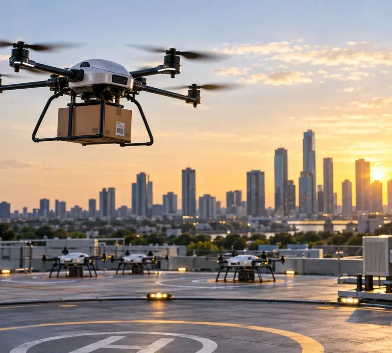
Remote fleet autonomy: missions can launch from docks, execute, return, recharge, upload data, and be supervised at fleet scale.
The quality test is intervention rate. If operators must frequently rescue the aircraft from navigation errors, re-fly missing areas, or manually correct framing, the system is not delivering useful autonomy for that mission, regardless of how many autonomous features appear on the specification sheet.
What changed most in commercial drone hardware?
The biggest recent shift is not a single component. It is the convergence of several improvements: denser edge computing, multi-modal obstacle sensing, more capable batteries and propulsion systems, precise RTK positioning, modular payload interfaces, stronger environmental protection, and docking infrastructure.
That convergence allows commercial drones to move from “a pilot flying a sensor” toward “a supervised robotic system producing a repeatable dataset or service.” The distinction is visible in inspection workflows. A useful autonomous inspection does not merely reach the asset. It follows the planned coverage, preserves safe standoff distances, maintains image overlap and focus, records accurate metadata, detects gaps, and returns with enough reserve to handle contingencies.
How should you judge mission quality?
A commercial drone purchase or architecture review should be tied to measurable outputs. The best metrics depend on the mission, but the following set works well as a starting point.
Mission completion rate: How often is the task completed without aborts or re-flights?
Human intervention rate: How often must a pilot override autonomy?
Data acceptance rate: What percentage of images, thermal frames, point clouds, or deliveries meet the downstream quality threshold?
Localization integrity: How often does position or heading confidence degrade beyond the mission limit?
Energy reserve at landing: Is there enough margin after wind, rerouting, and payload use?
Communications resilience: Does the system behave predictably during degraded or lost connectivity?
Maintenance burden: How many labor hours, battery replacements, calibrations, and component swaps are required per flight hour?
Environmental success rate: Does performance remain acceptable across the intended temperature, light, wind, dust, and precipitation envelope?
When should you change the approach?
Switching platforms or operating concepts is justified when repeated evidence shows that a core mission constraint is structural, not merely a tuning problem.
If hover time is the bottleneck on long linear surveys, consider fixed-wing or VTOL instead of adding more battery mass to a multirotor.
If GNSS degradation causes repeated autonomy failures, add visual or LiDAR-based localization, or redesign the mission to remain in reliable positioning zones.
If small wires or thin branches are critical hazards, do not assume a general obstacle-avoidance claim covers them. Validate the actual detection envelope or use a sensing stack designed for that hazard.
If cellular coverage is inconsistent, move more mission logic onboard and define safe lost-link behavior rather than relying on uninterrupted cloud control.
If the payload produces excellent raw data but creates too many re-flights, improve mission planning, stabilization, metadata, and quality checks before buying a higher-resolution sensor.
If regulatory approval is the main constraint, redesigning the route, altitude, area, staffing model, or operating category may be more effective than adding hardware.
Regulation is part of the system design
Autonomous capability does not by itself grant permission to operate autonomously. In the United States, the FAA's July 2026 Part 107 summary still describes visual line of sight as the baseline for small-drone operations, while its Advanced Operations page identifies BVLOS as an operation that may need additional approval. The FAA published a proposed BVLOS framework in August 2025 covering aircraft, separation, authorizations, security, reporting, and related requirements. Operators should verify the current rule status before building a business case around routine BVLOS.
In Europe, EASA's SORA guidance uses a risk-based process for many operations in the “specific” category. EASA's June 2026 rules incorporate SORA 2.5 and link operational risk to the robustness of technical, procedural, and organizational mitigations. In practical terms, hardware quality has to be demonstrated in the context of a defined operation, not judged in isolation.
The practical limit of autonomy
Commercial drones are becoming more capable because sensing, compute, control, and connectivity are improving at the same time. Yet the strongest systems are not the ones that promise to remove humans from every decision. They are the ones that make human supervision more effective, expose uncertainty, handle predictable failures safely, and produce consistent mission outputs.
That is the useful way to read the anatomy of an autonomous drone. Motors, batteries, LiDAR, cameras, AI processors, radios, and flight controllers are only ingredients. The finished product should be judged by evidence: repeatable mission completion, acceptable data quality, safe behavior at the edges of the operating envelope, and a regulatory path that matches the intended deployment.