Home
» New Trends
»
How Urban Air Traffic Control Systems Will Safely Manage Sky-High Congestion
How Urban Air Traffic Control Systems Will Safely Manage Sky-High Congestion
Urban air mobility will not scale safely by asking today’s air traffic controllers to manually handle every air taxi one by one. The emerging model is layered: early electric vertical takeoff and landing aircraft, or eVTOLs, will use much of today’s airspace structure and air traffic services, while higher-density operations are expected to add digital cooperative traffic-management services that share intent, prevent conflicts strategically, balance demand against capacity, and coordinate scarce vertiport resources.
That future is still being built. The Federal Aviation Administration’s current Urban Air Mobility Concept of Operations Version 2.0 is explicitly a concept, not a final policy or a prescribed implementation. It describes an evolutionary path from low-tempo operations under existing Visual Flight Rules (VFR) and Instrument Flight Rules (IFR) toward more automated, cooperative operations in defined urban airspace. As of September 2026, the FAA is also gathering real-world operational data through its eVTOL Integration Pilot Program.
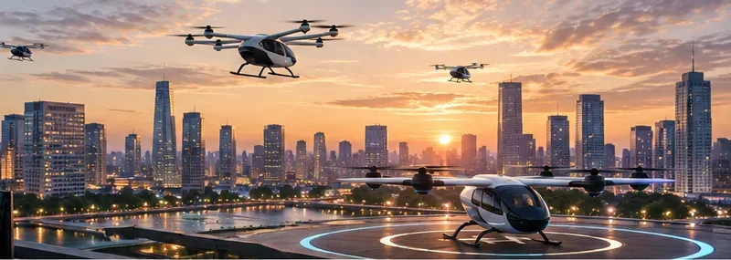
Several eVTOL aircraft operate around a rooftop vertiport in a dense city, illustrating the capacity and coordination challenge that future urban air traffic systems will need to manage.
Quick reference: what will actually manage urban air traffic?
Function
Primary purpose
Likely mechanism
Airspace access
Keep UAM compatible with the wider National Airspace System
Existing ATC rules initially; cooperative areas and corridors as operations mature
Strategic deconfliction
Prevent planned flights from competing for the same space and time
Shared operational intent evaluated before departure
Demand-capacity balancing
Stop demand from exceeding corridor, entry-point, or vertiport capacity
Slots, schedules, delays, reroutes, or other flow-management measures
Conformance monitoring
Detect when an aircraft deviates from its confirmed intent
Live position/identity data compared with the planned operation
Vertiport coordination
Prevent landing-pad and departure bottlenecks
Shared pad availability, arrival windows, and resource status
Contingency management
Handle weather, aircraft problems, closures, and off-nominal events
Alternative landing sites, constraints, ATC coordination, and predefined procedures
Why can’t conventional ATC simply handle thousands of air taxis?
Because conventional air traffic services are designed around a human-centered control model whose workload does not scale linearly to very dense short-haul operations. The FAA’s UAM concept notes that rising UAM volume could challenge existing air traffic services workforce resources if every operation depends on current ATS in the same way as traditional crewed aircraft.
NASA reached a similar conclusion much earlier in its high-density urban-air-mobility research. Its research on high-density UAM airspace integration describes the need to accommodate far more aircraft in a given airspace volume than the traditional control system was designed to manage. NASA has therefore explored extending ideas from UAS Traffic Management (UTM)—a digital, cooperative model originally developed for small unmanned aircraft—to more complex urban operations.
The practical takeaway is important: human controllers remain part of the safety architecture, especially where UAM aircraft interact with controlled airspace and conventional traffic, but routine coordination at high density is expected to rely much more heavily on machine-to-machine information exchange and operator automation.
How will the system evolve from today’s operations?
Stage 1: use today’s rules and routes wherever possible
The FAA expects initial AAM operations to resemble helicopter operations in several respects. Its current Advanced Air Mobility overview says early vehicles are expected to use existing infrastructure, routes, and air traffic control services where practical.
The FAA’s Innovate28 implementation plan similarly describes near-term operations in urban and metropolitan areas using existing or modified low-altitude VFR routes, with piloted aircraft and predetermined flight schedules. The agency’s Advanced Air Mobility Implementation Plan targets integrated operations at one or more sites as part of the path toward greater scale.
This means the first air-taxi services are not expected to immediately appear as fully autonomous swarms moving through a separate sky network. They will enter the aviation system incrementally.
Stage 2: introduce dedicated cooperative corridors as traffic grows
As operational tempo increases, the FAA concept introduces UAM Corridors. A corridor is a defined three-dimensional airspace volume in which participating operators can conduct cooperatively managed operations under specific rules, procedures, and performance requirements.
These corridors are not simply painted highways in the sky. They are airspace structures combined with data-sharing and traffic-management rules. Participating operators share planned flight intent and comply with common operating practices. Conventional ATC remains responsible for protecting the cooperative area from non-participating aircraft as required by the applicable concept and airspace environment.
The FAA’s mature-state concept anticipates much more automation, including remotely piloted or autonomous aircraft and highly automated cooperative flow management. The exact rules, separation standards, and implementation technologies are not final. The ConOps deliberately leaves those details for validation, regulation, and further research.
What is “operational intent,” and why is it so important?
Operational intent is the shared description of where and when an aircraft plans to operate. In the FAA concept, it contains spatial and temporal information and is exchanged among cooperative traffic-management participants.
Before a high-density UAM flight begins, the system can evaluate a proposed intent against:
other confirmed operations;
airspace restrictions and temporary constraints;
weather and other environmental limitations;
available UAM corridor capacity;
vertiport and landing-pad availability; and
applicable flow-management initiatives.
If the requested flight conflicts with another confirmed operation or exceeds a constrained resource, the system can modify the time, route, or resource assignment before departure. That is strategic deconfliction: reducing the likelihood that aircraft will meet in conflict by arranging their trajectories in advance.
This is safer and more scalable than waiting for two aircraft to become close enough that a controller or onboard system must resolve the conflict tactically.
Who provides these digital traffic-management services?
The FAA UAM concept defines a potential role called a Provider of Services for UAM (PSU). A PSU is envisioned as a service and data provider that helps an operator satisfy UAM operating requirements and serves as an interface among operators, other service providers, and the FAA ecosystem.
In the current concept, PSU functions can include:
sharing planned operations through a federated service network;
checking operational intent for strategic conflicts;
checking restrictions, weather, corridor capacity, and vertiport resources;
distributing advisories and FAA-originated information;
supporting conformance monitoring and other separation-management services;
sharing corridor-use status; and
archiving operational records for analysis and accountability.
A PSU does not mean the FAA gives up control of the National Airspace System. The FAA concept explicitly retains federal regulatory authority. The point is to avoid direct FAA involvement in every routine cooperative transaction when approved automation and service providers can perform scalable planning and information-exchange functions.
How will the system prevent congestion before it forms?
Strategic deconfliction prevents individual flight conflicts. Demand-capacity balancing (DCB) addresses a larger problem: what happens when too many aircraft want to use the same resource at the same time.
The constrained resource might be a corridor segment, a corridor entry or exit point, controlled airspace, or a destination vertiport. A city could have ample airborne route capacity while still experiencing a bottleneck because only a few landing pads are available.
The FAA defines DCB as a strategic process that evaluates traffic flow and aerodrome capacity so users can determine when, where, and how to operate while resolving competing demand.
Practical signs that DCB is working
Flights are assigned usable departure and arrival windows before launching.
A closed pad or constrained corridor reduces accepted demand upstream.
Operators receive constraints early enough to delay or reroute efficiently.
One operator cannot monopolize scarce capacity at the expense of the entire network.
Weather-related capacity reductions propagate through planning systems instead of becoming last-minute surprises.
Think of this as airport slot management, network traffic flow, and digital reservation logic adapted to a more distributed urban network.
Why are vertiports part of traffic control, not just infrastructure?
Because the landing site can become the dominant bottleneck.
The FAA’s current Advanced Air Mobility infrastructure guidance describes vertiports as a type of heliport and links current design guidance to Engineering Brief 105A, published December 27, 2024. The guidance currently focuses on pilot-onboard VTOL operations in Visual Meteorological Conditions for the specified reference class of aircraft.
In the UAM traffic-management concept, a vertiport publishes resource status such as whether the facility is open and whether pads are available. Operators and service providers use that data during strategic deconfliction and demand-capacity balancing.
A useful operational rule follows: do not release an aircraft into a dense corridor unless the destination resource is realistically available. Otherwise, airborne holding or emergency diversions can turn a ground-capacity problem into an airspace-safety problem.
How will aircraft be tracked after departure?
Planning alone is not enough. Once airborne, the system needs conformance monitoring: comparing what an aircraft is actually doing with its confirmed operational intent.
The FAA concept expects aircraft identification and position information to be available to relevant operators and service providers, and to ATC when operating across applicable controlled environments. If an aircraft deviates from its planned space-time volume, the system can generate advisories, trigger coordination, or escalate to tactical conflict-management procedures.
The exact surveillance mix may differ by operating environment and regulation. It may include existing aviation surveillance, networked position data, vehicle-to-vehicle information, or future capabilities. It would be misleading to claim that one specific technology such as ADS-B alone is the universal future solution.
What happens when a flight crosses between a UAM corridor and conventional controlled airspace?
This interface is one of the hardest parts of the problem.
The FAA’s UAM ConOps includes scenarios in which an aircraft departs from Class B airspace, enters a cooperative UAM corridor, and later re-enters Class B airspace. In that concept, the operator and PSU exchange information with traditional Air Traffic Services, and the flight continues to comply with ATC requirements while it is in the controlled ATS environment.
That suggests a hybrid future rather than two isolated systems:
Environment
Typical management emphasis
Traditional controlled airspace
FAA Air Traffic Services, current separation and flight rules
How will the system respond to emergencies and off-nominal events?
A safe traffic-management design assumes flights will occasionally deviate from plan. Weather can deteriorate. A vertiport can close. Communications can degrade. An aircraft can experience a technical problem. Emergency helicopters or other priority traffic can create sudden constraints.
The FAA concept expects operators to plan for off-nominal events, including knowing alternative landing sites and understanding the neighboring airspace around a corridor. A mature system therefore needs contingency logic at multiple levels:
Aircraft level: detect failures and maintain a safe flight state.
Operator level: select alternates, modify intent, and coordinate priority actions.
Network level: publish constraints, protect affected airspace, and rebalance traffic.
ATC interface: escalate appropriately when a contingency enters or affects conventional controlled airspace.
No traffic-management network can guarantee that every aircraft remains on schedule. The safety objective is to remain predictable and recoverable when the schedule breaks.
What role will automation and AI play?
Automation is central to scale, but it should not be confused with unconstrained artificial intelligence making independent airspace policy.
The FAA concept anticipates increasing levels of automation in planning, data exchange, conflict management, and eventually aircraft operation. NASA’s Air Traffic Management–eXploration (ATM-X) work continues to research digital aviation ecosystems in which traditional and emerging vehicles can operate together.
AI may contribute to demand forecasting, anomaly detection, trajectory prediction, weather interpretation, or optimization. But safety-critical decisions still require validated rules, deterministic constraints where appropriate, auditable data, certified systems, and clearly assigned responsibility. A machine-learning model that predicts congestion is not, by itself, an approved separation standard.
What is already real in 2026, and what is still conceptual?
Status
Examples
Already established or active
Powered-lift operating and pilot-certification framework; FAA vertiport design guidance; current ATC/airspace rules; the FAA eVTOL Integration Pilot Program; multiple 2026 demonstration flights under eIPP
Near-term implementation direction
Piloted AAM operations using existing infrastructure, routes, and ATC services where practical; site-specific integration and operating agreements
The distinction is especially important because real-world AAM testing is accelerating. On March 9, 2026, the FAA announced eight selected proposals for the new eIPP, and subsequent 2026 demonstrations have included medical transport, hybrid-electric regional flights, and remotely piloted cargo testing. These demonstrations provide operational data; they do not mean the far-term high-density UAM architecture has already been deployed.
Practical safety checklist for a high-density urban-airspace system
Known intent: every participating flight has a valid, shareable space-time plan.
Known capacity: corridor, transition point, and vertiport limits are visible to planners.
Preflight deconfliction: conflicts are removed before aircraft launch whenever possible.
Live conformance: actual aircraft position is monitored against confirmed intent.
Interoperable data: operators and service providers use common standards and timely information.
ATC compatibility: cooperative services do not obscure responsibility in controlled airspace.
Priority handling: emergency and public-safety operations can override normal flow when required.
Weather awareness: capacity changes when wind, visibility, icing, or other conditions reduce usable performance.
Vertiport integration: landing resources are treated as part of network capacity.
Cybersecurity: identity, authorization, data integrity, and service continuity are protected.
Fallback procedures: operators have alternate landing, communication, and routing options.
Human responsibility: automation roles and escalation paths remain explicit and testable.
What should city planners and infrastructure operators focus on?
Municipalities do not control the navigable airspace—the FAA retains that authority in the United States—but local decisions still matter. Vertiport siting, zoning around approach paths, power infrastructure, emergency access, surface-transport links, community noise exposure, land use, and equitable access can all affect whether a UAM network is operationally useful.
The FAA’s ConOps encourages state, local, and metropolitan planners to integrate vertiport planning into broader transportation and utility planning. A city that builds multiple pads without considering airspace constraints, electric capacity, ground access, or network demand could create infrastructure that is technically impressive but operationally difficult to use.
Bottom line
The safest path to dense urban air traffic is not a single “flying-car control tower.” It is a layered system that combines the regulatory authority and safety responsibilities of conventional aviation with much more automated, cooperative traffic management.
Early air taxis will fit into existing aviation rules wherever possible. As traffic increases, shared flight intent, UAM corridors, digital service providers, strategic deconfliction, demand-capacity balancing, vertiport scheduling, and conformance monitoring are intended to absorb routine coordination that would otherwise overwhelm human-centered ATC.
The mature architecture is still being validated, and the FAA’s own blueprint says so. That uncertainty is not a weakness; it is the reason current pilot programs, simulation, research, certification, and staged deployment matter. High-density urban flight will become practical only if capacity grows without allowing complexity to grow faster than the safety system can control it.