Home
» New Trends
»
Solving the UTM Puzzle: A Practical Guide to AI-Driven Deconfliction in Low-Altitude Airspace
Solving the UTM Puzzle: A Practical Guide to AI-Driven Deconfliction in Low-Altitude Airspace
Low-altitude airspace becomes difficult to manage long before the sky looks visibly crowded. A delivery drone may reserve a corridor for only a few minutes, an inspection aircraft may need to deviate around a crane, a public-safety flight may receive priority, and a temporary restriction can invalidate several routes at once. The operational problem is not simply “detect two aircraft that are close.” It is to predict where conflicts can develop, resolve them early, keep every participant synchronized, and still have a safe fallback when reality no longer matches the plan.
That is the core deconfliction problem in unmanned aircraft system traffic management, or UTM. The U.S. Federal Aviation Administration describes UTM as a collaborative ecosystem for low-altitude unmanned aircraft operations that is separate from, but complementary to, traditional air traffic services. It relies heavily on highly automated digital services and API-based information exchange rather than continuous voice control. See the FAA UTM overview.
Artificial intelligence can make that ecosystem more predictive and scalable, but it should be understood as a decision-support and optimization layer, not as a substitute for regulatory rules, interoperable data, deterministic safety constraints, or aircraft-level contingency capability. A practical design uses AI where uncertainty and combinatorial complexity are high, while keeping hard safety boundaries explicit and auditable.
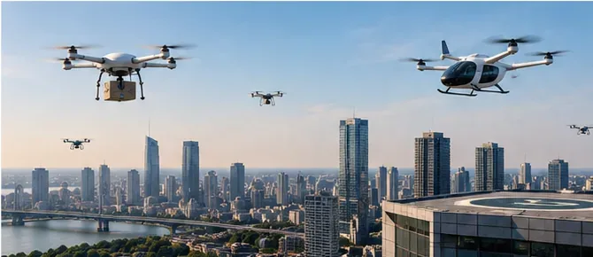
Multiple low-altitude aircraft sharing an urban operating area illustrate why UTM needs coordinated intent sharing, deconfliction, and reliable fallback behavior.
The shortest useful model: plan, monitor, recover
A deployable deconfliction system is easier to reason about when it is divided into three layers:
Layer
Main question
Typical inputs
Best use of AI
Strategic deconfliction
Can planned operations coexist before they launch?
Advisory support where assured, but immediate safety actions should not depend on a remote AI service alone
The FAA’s UTM Concept of Operations describes operation intent as four-dimensional volumes defined in space and time. Strategic coordination minimizes overlap among those volumes, while tactical methods are needed when strategic deconfliction alone is not sufficient. The concept is especially important for BVLOS operations, where shared intent becomes a key part of situational awareness. See the FAA UTM Concept of Operations v2.0.
What AI should actually do inside UTM
1. Predict trajectory occupancy, not just a single line
A nominal route is not enough. Wind, navigation error, vehicle performance, communications delay, and operator behavior all create uncertainty. Instead of predicting one future point, a useful model estimates a probability distribution or bounded occupancy volume over time. That allows the scheduler to answer a more realistic question: “What airspace could this aircraft occupy during the next 30, 60, or 120 seconds?”
The output should be paired with a confidence measure. If confidence drops because telemetry is stale or weather uncertainty rises, the system should enlarge buffers or escalate the case rather than pretending the prediction is precise.
2. Detect conflicts in four dimensions
Conflict detection should combine horizontal position, altitude, and time. Two paths that cross on a map are not necessarily a conflict if the aircraft pass through the intersection several minutes apart. Conversely, two aircraft that are vertically separated on paper can become a concern if one is climbing, descending, or deviating from its authorization.
A practical engine first applies deterministic geometry and time-window checks, then uses probabilistic prediction to prioritize which apparent conflicts deserve attention. This hybrid approach is easier to verify than asking a machine-learning model to make the entire safety decision from raw telemetry.
3. Generate multiple conflict-free options
When a conflict is found, the objective is rarely “find any route that works.” Operators care about delay, battery use, mission deadlines, noise-sensitive areas, restricted zones, communications coverage, and fairness across service providers. AI-based optimization is useful because it can search a large set of alternatives quickly.
Candidate resolutions commonly include a departure delay, speed adjustment, altitude change where permitted, rerouting around a constrained volume, or a combination of these. The optimizer should return several feasible options with costs and constraints, not a single unexplained command.
4. Forecast congestion before individual conflicts appear
Deconfliction becomes harder when every conflict is handled locally at the last moment. Demand forecasting can predict that a corridor, vertiport approach, or inspection zone will become saturated 10 or 20 minutes later. The system can then meter departures or redistribute routes before the operating picture becomes unstable.
This is one of the strongest uses for machine learning because traffic demand, weather, recurring delivery peaks, and mission patterns can have complex temporal relationships. The forecast is still advisory; the capacity rule that acts on it should remain explicit.
5. Detect non-conformance early
Conformance monitoring compares actual flight behavior with the authorized or intended operation. A simple threshold can flag a breach after it occurs. A predictive model can go one step earlier by estimating whether current speed, heading, wind, and control behavior are likely to produce a breach soon.
Recent NASA work has examined the combination of pre-departure four-dimensional strategic deconfliction and conformance monitoring for situational awareness in simulation studies. That research is useful because it treats deconfliction as a layered risk-mitigation problem rather than a single algorithm. See the NASA Technical Reports Server study on strategic deconfliction and conformance monitoring.
Do not confuse U.S. UTM with European U-space
The concepts overlap, but the regulatory structures are not identical. In the United States, the FAA frames UTM as a cooperative ecosystem supporting low-altitude operations, with current implementation work focused heavily on strategic coordination for overlapping BVLOS operations. The FAA notes that it has begun issuing Letters of Acceptance to service providers supporting strategic deconfliction services through its near-term implementation work.
In the European Union, U-space is defined through a regulatory framework. As of September 2026, the consolidated version of Commission Implementing Regulation (EU) 2021/664 available on EUR-Lex is dated February 22, 2026. It requires four core services in designated U-space airspace: network identification, geo-awareness, UAS flight authorization, and traffic information. Member States may require additional services such as weather information and conformance monitoring based on the airspace risk assessment. See the EASA U-space FAQ and the current consolidated EU regulation.
This distinction matters for system design. An AI component that is acceptable as an internal optimization aid for one operator is not automatically a certified U-space service or an approved means of compliance in Europe. Regulatory responsibility, service-provider roles, data requirements, and assurance evidence must be mapped explicitly for the jurisdiction where the system will operate.
Minimum data contract for credible deconfliction
Before selecting a model, define the data contract. A practical UTM deconfliction service usually needs, at minimum:
Operation identity and authorization state: who is operating, what mission is active, and whether the flight is proposed, accepted, activated, changed, or ended.
Four-dimensional intent: planned geometry, altitude band, entry and exit times, and tolerances.
Live state: position, altitude reference, speed, heading, timestamp, and quality indicators.
Airspace constraints: permanent and temporary restrictions, geozones, dynamic constraints, and their effective times.
Manned-traffic information where applicable: especially important in mixed airspace where UAS and crewed aircraft can interact.
Weather: current conditions plus forecast uncertainty relevant to trajectory prediction.
Data provenance: source, update time, version, latency, confidence, and integrity status.
European U-space rules are particularly explicit about data quality, latency, update frequency, interoperability, and the role of services such as network identification and geo-awareness. EASA’s rules and guidance describe continuous processing of identification data and emphasize timely dissemination of constraints and traffic information. See the EASA Easy Access Rules for U-space.
An illustrative conflict-resolution example
Consider two delivery drones approaching the same narrow urban corridor. Drone A plans to enter the corridor at 10:02:20 and remain for 70 seconds. Drone B plans to enter at 10:02:50 from the opposite direction. Their authorized volumes overlap in both space and time.
A deterministic conflict detector flags the intersection. The optimization layer then evaluates several resolutions: delay Drone B by 60 seconds, reroute Drone A around the block, or move one aircraft to another altitude band if local rules and vehicle capability allow it. The AI model estimates the cost and likelihood of successful execution for each option, but the final candidate list is filtered through hard constraints such as geozones, minimum separation policy, vehicle limits, priority rules, and required reserve energy.
This is an illustrative scenario, not a reported flight-test result. Its value is to show the division of responsibility: machine learning can rank and predict; verified rules decide what is permissible.
Failure modes that deserve more attention than model accuracy
Stale intent: one service provider is optimizing against an operation plan that another provider has already changed.
Clock mismatch: a few seconds of time skew can corrupt four-dimensional conflict calculations.
Altitude-reference mismatch: mixing height above ground, height above takeoff, and mean sea level can create dangerous false separation.
Overconfident prediction: a model reports a narrow uncertainty band even when telemetry or weather quality is poor.
Cascading reroutes: resolving one conflict creates two more downstream.
Communications loss: a cloud service cannot assume it can always reach the aircraft.
Non-cooperative traffic: the system may not have complete intent or telemetry for every airborne object.
Automation bias: operators may accept a recommendation because it came from an optimization engine rather than because its constraints were independently checked.
Metrics that make a pilot program meaningful
A prototype should not be judged only by “conflicts resolved.” Track a balanced set of safety and operational metrics:
Metric
Why it matters
Conflict-detection recall
Shows whether meaningful conflicts are being missed.
Measures whether a solution arrives while it is still operationally useful.
Added delay and distance
Captures efficiency cost of safety actions.
Secondary-conflict rate
Reveals whether rerouting creates new downstream problems.
Conformance-detection time
Shows how quickly unexpected behavior is recognized.
Fallback success rate
Tests the system when communications, data, or AI services fail.
Fairness across operators
Helps prevent one participant from consistently absorbing delays or route penalties.
NASA’s earlier Technical Capability Level 4 work is a useful reference for strategic deconfliction testing because it evaluates discoverable four-dimensional operation volumes and cooperative information exchange among operators. See the NASA strategic deconfliction performance report.
Implementation checklist
Define the regulatory role of every component before designing the AI architecture.
Keep non-negotiable safety constraints in deterministic, testable logic.
Represent uncertainty explicitly rather than hiding it inside a point prediction.
Synchronize clocks and altitude references across every participating service.
Version all airspace constraints and operation-intent updates.
Design for cross-provider interoperability, not a single closed fleet.
Test dense traffic, degraded telemetry, weather changes, lost communications, and non-conforming aircraft.
Run new prediction or optimization models in shadow mode before giving them operational influence.
Maintain an aircraft-level contingency path that does not depend on cloud connectivity.
Log inputs, model versions, candidate resolutions, rule rejections, operator actions, and final outcomes for auditability.
Evaluate cybersecurity and identity integrity as safety dependencies, not separate IT concerns.
Where AI should stop
The most important architectural boundary is simple: AI should not quietly become the authority merely because it produces good recommendations in simulation. Safety-critical decisions need traceable rules, validated interfaces, known failure behavior, and a clear allocation of responsibility. In high-consequence situations, an explainable conservative fallback is usually more valuable than a slightly more efficient but opaque prediction.
That boundary is consistent with the direction of current UTM and U-space frameworks. Both emphasize interoperable digital services, shared information, structured authorizations, and layered risk management. Neither framework makes “AI” itself the safety case.
Practical takeaway
AI-driven deconfliction is most valuable when it solves the parts of low-altitude traffic management that are genuinely hard to scale: predicting uncertain trajectories, ranking emerging conflicts, optimizing many competing route options, and forecasting congestion. But the surrounding system still needs deterministic constraints, reliable identity and intent exchange, conformance monitoring, tactical or contingency capability, and regulatory assurance.
If you are designing a UTM platform, start with the data contract and safety layers, not the model. Then add AI where it improves prediction or optimization measurably, validate it under degraded conditions, and keep every recommendation inside an auditable operational envelope. That approach turns AI from a buzzword into a useful component of a scalable low-altitude airspace system.