Home
» New Trends
»
Navigating the Low-Altitude Economy: Building UTM for Scalable, Shared Airspace
Navigating the Low-Altitude Economy: Building UTM for Scalable, Shared Airspace
The practical problem in the low-altitude economy is no longer whether drones can fly useful missions. They already inspect infrastructure, support emergency response, deliver goods, map construction sites, and monitor agriculture. The harder problem is what happens when many operators want to use the same airspace at the same time, often beyond visual line of sight, alongside helicopters, general aviation, emergency aircraft, and eventually larger advanced air mobility vehicles.
That is the problem UAS Traffic Management, or UTM, is meant to solve. The key shift is from managing one operation at a time to coordinating a network of operations through shared digital services. As of September 2026, that transition is visible in several major markets. The FAA describes UTM as a collaborative ecosystem of regulatory requirements, interoperable services, and technical capabilities for low-altitude drone operations. Europe already has a formal U-space framework with mandatory digital services. China is expanding low-altitude flight-service infrastructure while drone activity continues to rise rapidly. The direction is clear even though the implementation models differ: scalable low-altitude aviation needs a trusted digital traffic layer.
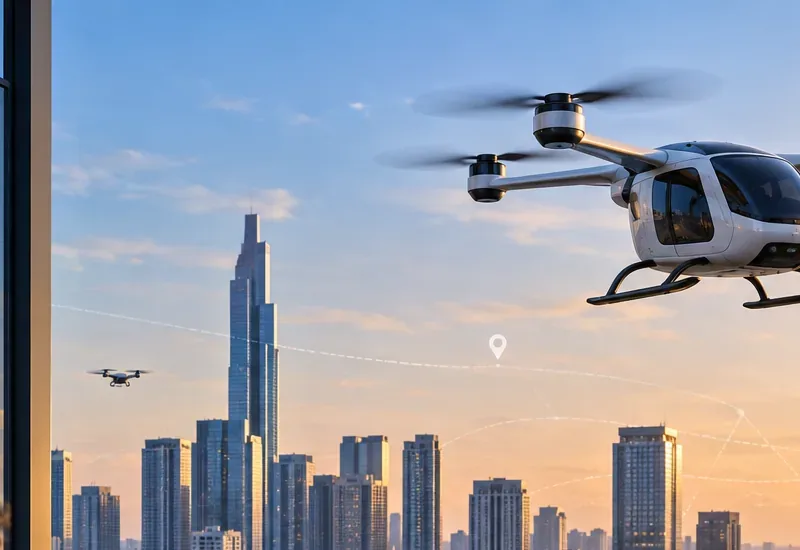
A large multirotor aircraft and smaller drones fly above a dense city skyline, illustrating the mix of low-altitude traffic that future UTM systems must coordinate safely.
Why today's operating model breaks down as traffic grows
A small number of drone flights can often be managed through individual authorizations, local procedures, geofencing, visual observers, and manual coordination. Those methods become expensive and slow when operations scale across a city, utility network, logistics corridor, or emergency-response area.
In the United States, the FAA's current Part 107 summary still states that a remote pilot generally must keep the drone within sight. At the same time, the FAA's 2025 BVLOS proposal describes a future model in which operators could use approved Automated Data Service Providers to support separation and other scalable services. The FAA also expanded its BEYOND program in August 2026 to support more advanced drone operations. These developments show that the bottleneck is shifting from aircraft capability toward repeatable authorization, service assurance, data exchange, and airspace coordination.
What to do first: treat UTM as infrastructure, not as a single app. A scalable design must define who supplies authoritative data, who provides services, how operators exchange intent, how conflicts are managed, and what happens when a service fails.
Misconception 1: UTM is simply air traffic control for drones
That comparison is useful at a high level but misleading in architecture. Traditional air traffic management relies heavily on centralized air navigation services and controller-managed separation. UTM was developed around a more distributed, service-oriented model in which operators and service suppliers exchange flight intent and other information digitally. NASA's UTM research explicitly explored this collaborative approach, and the FAA now describes UTM as separate from but complementary to air traffic services.
This distinction matters because low-altitude operations can be far denser and more geographically distributed than conventional controlled-airspace traffic. A human controller cannot realistically issue tactical instructions to every delivery drone in a large metropolitan area.
Action: design automation for routine coordination, but define clear boundaries for when responsibility transfers to an operator, air navigation service provider, public-safety authority, or other human decision-maker. Start with the FAA's current UTM overview and NASA's UTM research summary.
Misconception 2: Remote ID is enough to manage traffic
Remote identification is important, but identity alone does not create a traffic-management system. A useful UTM environment needs to know more than who an aircraft is. It may need current position, intended route or operating volume, airspace constraints, priority status, conformance information, nearby crewed traffic, weather, and contingency state.
Europe's U-space framework makes the difference concrete. EASA lists four mandatory services in designated U-space airspace: network identification, geo-awareness, UAS flight authorization, and traffic information. Optional services can include weather information and conformance monitoring. The current consolidated EU regulation also requires interoperable information exchange and defines responsibilities for U-space service providers and common information services.
Action: build identity as one data service among several. Do not use Remote ID as a substitute for flight authorization, conflict management, or conformance monitoring. The EASA U-space overview and the current consolidated EU U-space regulation provide useful reference models.
Build the foundation: authoritative data before advanced optimization
The easiest UTM capability to underestimate is data quality. Strategic deconfliction only works when flight intent is timely and accurate. Geo-awareness is useful only when temporary restrictions, critical infrastructure constraints, and local operating conditions reach the system quickly. Traffic information is useful only when positions are sufficiently fresh and trustworthy for the intended risk level.
That means the first engineering priority should be a dependable common data layer. At minimum, a mature low-altitude environment needs:
authoritative airspace and geographic restriction data;
operator and aircraft identity appropriate to the regulatory framework;
planned operating volumes or flight trajectories with time windows;
real-time or near-real-time aircraft state where required;
weather and localized environmental data for missions that depend on it;
priority and emergency information;
versioning, timestamps, provenance, and quality indicators for safety-relevant data.
Action: before adding route optimization or AI-based scheduling, measure data latency, completeness, freshness, and failure behavior. If the source of a restriction or position update cannot be trusted, the rest of the UTM stack cannot safely compensate.
Next, make service providers interoperable instead of creating new silos
A low-altitude economy will not scale well if every city, operator, fleet, and service provider uses incompatible interfaces. Interoperability is therefore more than a technical convenience; it is a market-access and safety requirement.
ICAO's UTM framework emphasizes global harmonization because fragmented national or regional implementations can affect safety, security, reliability, environmental outcomes, and economic efficiency. Europe has taken a regulated service-provider approach through certified U-space service providers. The U.S. is exploring a different model, but its BVLOS proposal also points toward regulated third-party services for scalable operations.
Action: define open, versioned interfaces for flight intent, authorization state, restrictions, conformance events, traffic information, and contingency notifications. Keep proprietary optimization behind the interface rather than making the interface itself proprietary. For global context, see ICAO's UTM Framework, Edition 4.
Then solve conflict management at two time scales
Strategic conflict management happens before or around flight authorization. The system can compare proposed operating volumes in four dimensions: latitude, longitude, altitude, and time. This is relatively tractable when operators submit good intent data.
Tactical conflict management is harder. Aircraft may deviate because of wind, navigation error, lost links, emergency behavior, or unexpected crewed traffic. A future UTM system therefore needs conformance monitoring, alerting, and clearly defined contingency rules. It may also need to interact with onboard detect-and-avoid capabilities, but the two are not interchangeable. A network service can improve shared situational awareness; an aircraft still needs an approved means of maintaining safety when communications or external services degrade.
Action: separate strategic deconfliction from tactical safety functions in both architecture and assurance cases. Test loss of network, stale traffic data, conflicting priorities, route deviation, emergency landing, and sudden airspace closure as first-class scenarios.
Do not confuse connectivity with traffic management
5G, satellite links, dedicated aviation communications, and other networks can improve command-and-control or data exchange, but connectivity alone is not UTM. The system still needs service definitions, data integrity, cybersecurity controls, operational responsibilities, and degraded-mode behavior.
This is especially relevant in dense urban areas, where buildings can affect radio propagation and where a single communications provider may become a common-mode dependency. NASA's earlier urban UTM demonstrations specifically examined communication challenges, localized weather, and safe landing considerations in cities.
Action: design for multiple communications paths where the risk case requires them. Measure end-to-end service availability and latency rather than assuming that nominal network coverage equals operational reliability.
Security and governance become part of airworthiness at scale
When UTM services influence authorization, separation, or emergency response, cybersecurity is no longer just an IT concern. A compromised identity service, false airspace restriction, spoofed position feed, or denial-of-service attack can have operational consequences.
Governance also matters because the system may handle commercially sensitive routes, operator identity, security restrictions, and location data. Europe addresses some of these responsibilities through certification and common information services. Other jurisdictions may use different institutional models, but the core requirement is the same: safety-relevant data needs controlled access, integrity protection, accountability, and auditability.
Action: include threat modeling, authentication, authorization, signed or otherwise integrity-protected messages where appropriate, incident logging, recovery procedures, and independent service assurance in the original UTM architecture—not as a later cybersecurity add-on.
The low-altitude economy makes scale measurable
The phrase “low-altitude economy” is broad, but the underlying operational pressure is measurable. CAAC reported that China had 3.287 million registered drones by the end of 2025, up 51 percent from the previous year, with 45.3 million cumulative drone flight hours during 2025. The same bulletin reported 46 low-altitude flight service stations covering 23 provincial-level regions. In May 2026, China's civil aviation regulator also established a dedicated low-altitude safety department responsible in part for low-altitude flight-service dispatch platforms and station systems.
Those figures should not be treated as a universal forecast for other countries. They do, however, show what happens when an unmanned aviation market reaches sufficient scale: traffic-management services become physical and digital infrastructure, not a pilot project.
A credible future UTM architecture is likely to be federated rather than monolithic. Regulators and air navigation authorities define safety and access requirements; authoritative information services publish trusted constraints; certified or approved service providers support operators; aircraft contribute identity and state information; and operators remain responsible for complying with the rules of the operating environment.
The strongest systems will combine five properties:
Interoperability: multiple providers can exchange safety-relevant information without private bilateral integrations for every pair.
Performance assurance: latency, availability, integrity, and continuity targets are measurable for each service.
Dynamic airspace management: restrictions and priority operations can change quickly without forcing the entire system into manual coordination.
Graceful degradation: loss of one service or communications path does not create an immediate unsafe state.
Integration with crewed aviation: UTM does not form an isolated drone layer; it exchanges the information needed to coexist with helicopters, general aviation, airports, emergency services, and future AAM operations.
How to self-check whether a UTM program is actually ready to scale
A useful maturity review is less about how impressive the dashboard looks and more about what happens under stress. Ask the following questions:
Can two independent service providers exchange flight intent and authorization state correctly?
Can the system prove which airspace restriction was valid at a specific time?
How quickly does a new emergency restriction propagate to active operators?
What happens if traffic information is delayed, duplicated, or contradictory?
Can an operator continue safely if a UTM provider or communications network becomes unavailable?
Are responsibilities clear when an aircraft deviates from its authorized volume?
Can public-safety flights receive the priority treatment required by the local regulatory framework?
Are safety, cybersecurity, privacy, and operational logs auditable after an incident?
Has the system been tested with the traffic density expected in commercial operations rather than only demonstration volumes?
If those answers are unclear, adding more drones will increase complexity faster than economic value. If they are measurable, tested, and governed, UTM starts to become what the low-altitude economy actually needs: dependable infrastructure that lets many operators share constrained airspace without requiring every flight to be managed as a special case.
The future of UTM is not one global system, but compatible rules of the digital sky
There is no evidence that every country will converge on a single provider model or identical regulatory architecture. The U.S. UTM approach, European U-space regulation, and China's low-altitude service infrastructure already show meaningful differences. The more realistic goal is interoperability around common safety functions: identity, intent, authorization, geo-awareness, traffic information, conformance, contingency management, and trusted interfaces with conventional aviation.
That is the central challenge of the low-altitude economy. Aircraft technology can improve quickly, but economic scale depends on whether the airspace system can turn thousands of individually feasible flights into a predictable, safe, and interoperable transportation network. Building that digital traffic layer is what will determine whether low-altitude aviation remains a collection of local demonstrations or becomes durable infrastructure.